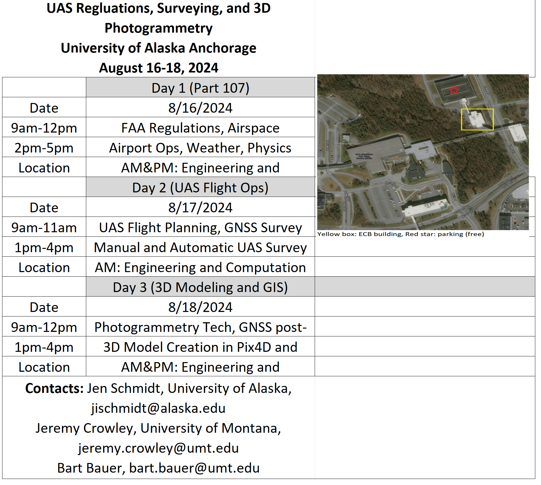
If you complete the three classes listed below, you will receive a certificate from the Community & Technical College. To gain an occupational endorsement certificate you will need to take an additional 6 credits for a total of 9 credits at UAA. We are still in the process of determining which classes are eligible for the 6 additional credits.
ATP A107 Remote Pilot Aircraft System Part 107 (Asynchronous) – Credits: 1
Introduces the history, applications, and technologies of unmanned aerial systems (UAS). Prepares the student to take the Federal Aviation Administration (FAA) Part 107 test.
ATP A207 Remote Piliot Applications (Asynchronous) – Credits: 1
Studies major subsystems common to most Unmanned Aircraft Systems (UAS), and provides advanced UAS platform training. Covers UAS power systems, autopilot systems, user-interface software, sensors, aerodynamics, flight controls, airborne communication systems, as well as mission design, planning, execution, and analysis. Includes the challenges of UAS integration into the national airspace system, crew qualifications and training, safety, and human factors.
Special Note: UAS Part 107 License is needed prior to the start of this course.
ATP A208 Remote Pilot Flight Operations (Late Spring 2025) – Credits: 1
Presents the practical elements of Remote Pilot operations. Exposes students to physical interaction with Unmanned Aerial Systems (UAS) and flight in the National Airspace System (NAS) after completion of the Federal Aviation Administration Part 107 license and the advanced drone operations course.
Special Note: Enrolled students must present a current FAA Part 107 license.
Unmanned Aerial Systems (UAS) or Drones training materials
WORKSHOP HELD AT THE UNIVERSITY OF ALASKA
August 16-18th, 2024:
Click here to get the flyer for the course.
If interested don’t hesitate to get in touch with Dr. Jen Schmidt (jischmidt@alaska.edu)

Workshop Presentations 2024
- FAA Part 107 UAS Remote Pilot Prep- Part 1
- FAA Part 107 UAS Remote Pilot Prep- Part 2
- GNSS Surveying
- Introduction to UAS, flight planning, and apps
- GNSS Surveying
- GNSS RTK
- Post-process in Emlid Studio
- UAS for Water Resources
- Pix4Dmapper tutorial
- Setting up a M2
- Setting up a ReachRS2+
Pix4D tutorial videos – https://support.pix4d.com/hc/en-us/articles/360031682092
Test Materials (2024)
Class recordings (2024)
Funding and support
National Science Foundation: Natural Resource Supply Chain Optimization using Aerial Imagery Interpreted with Machine Learning Methods (# 2119689)


